Marine Spatial Management
Our Western Pacific Region has the largest marine jurisdiction of the councils, covering more than 1.5 million square nautical miles (nm) and including one state (Hawaii), two territories (American Samoa and Guam), one commonwealth (Commonwealth of the Northern Mariana Islands, CNMI), and several Pacific Remote Island Areas. The Council and its advisory bodies routinely explore the utility of area-based management tools in relation to fisheries management, which encompass more than marine protected areas. In 1986, the Council prohibited bottom trawling to protect seafloor and other non-target species, effectively making the the entire US exclusive economic zone a marine managed area The Council was the first to establish large area closures to pelagic fisheries, beginning in 1991 throughout the Hawaiian Archipelago. The Council’s adaptive and iterative “bottom-up” process is by design, providing the opportunity for stakeholder input on area-based management. The designation of Marine National Monuments were overlaid on these previous efforts by the Council.
National Marine Sanctuary Proposals
Under the 1972 Marine Protection, Research and Sanctuaries Act, the Secretary of the Department of Commerce is authorized to designate areas in the ocean as national marine sanctuaries to promote comprehensive management of their special conservation, recreational, ecological, historical, research, educational or aesthetic resources. There are three sanctuary proposals located in the Western Pacific Region: the Pacific Remote Islands, Northwestern Hawaiian Islands (NWHI) and Mariana Trench.
As part of the designation process, the NOAA Office of National Marine Sanctuaries (ONMS) works with the Council to assess and determine the need for fishery regulations to meet the goals and objectives of the sanctuary. The Council can recommend fishing regulations, recommend that fishing regulations are not necessary, or decline to act. The Secretary of Commerce may develop fishing regulations if the Council proposes regulations that do not meet the goals and objectives of the sanctuary, refuses to recommend regulations, or fails to act in a timely manner.
Go to the Top
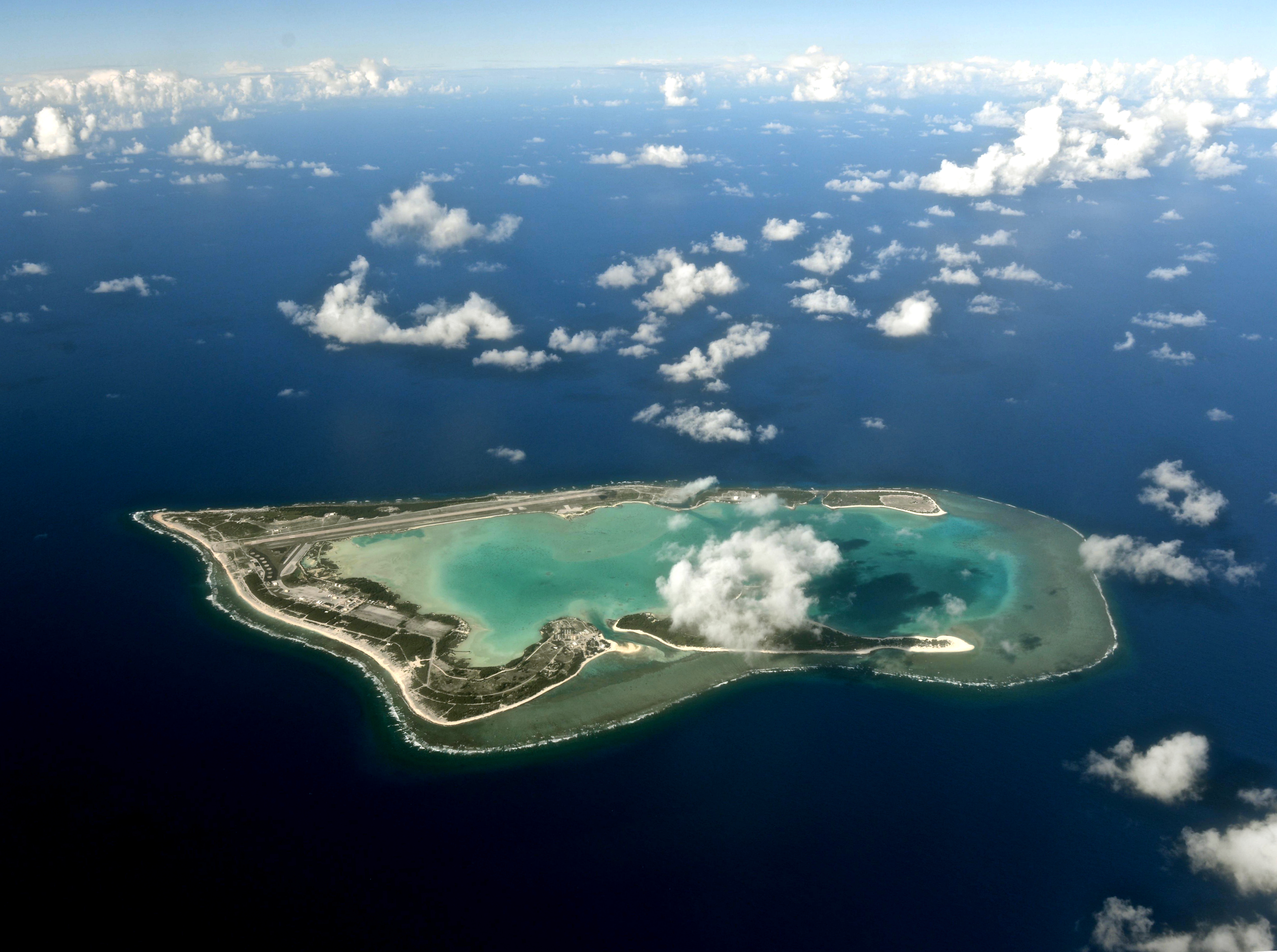
Proposed National Marine Sanctuary around the Pacific Remote Islands
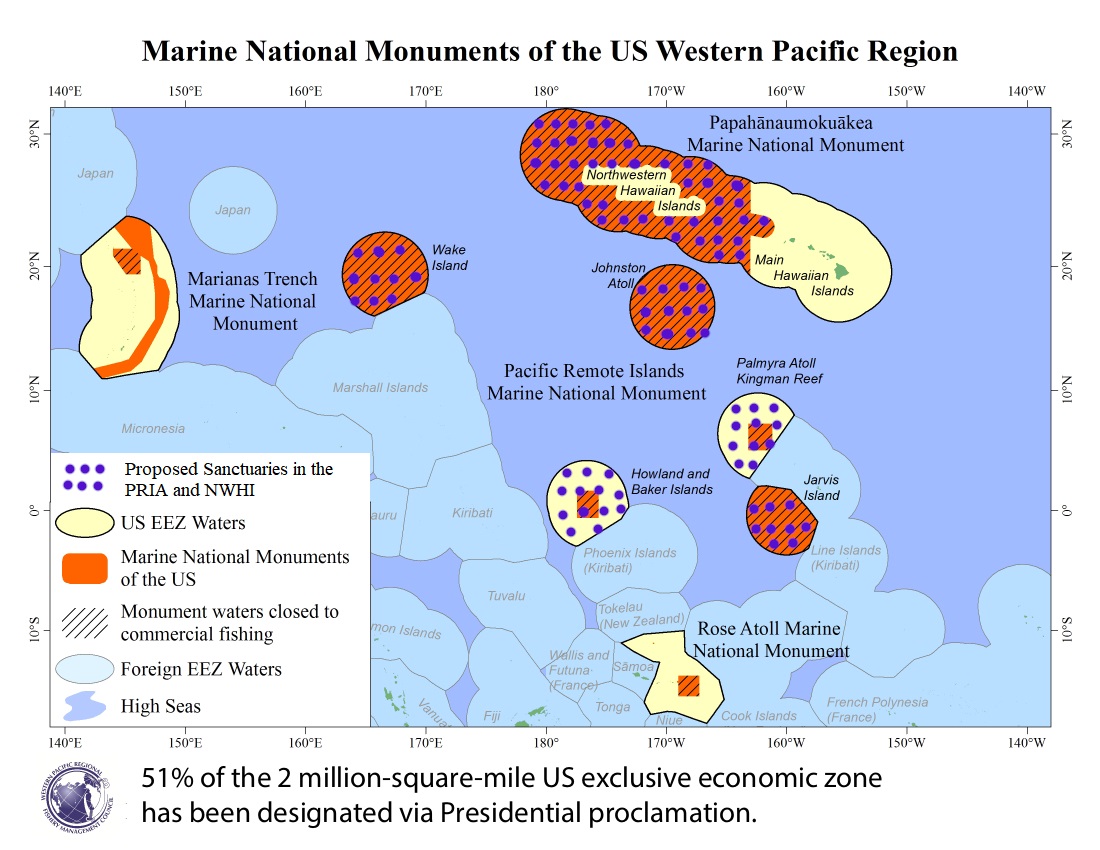
On March 11, 2023, the Pacific Remote Islands Coalition submitted a National Marine Sanctuary nomination to NOAA protect U.S. waters to the extent of the EEZ around the Pacific Remote Islands (PRI). On March 21, 2023, President Biden directed the Secretary of Commerce to consider initiating the designation process for the nomination within 30 days. The White House fact sheet stated this action would reach the President’s goal of conserving at least 30% of U.S. ocean waters by 2030. ONMS provides a timeline on the proposed designation on its website (https://sanctuaries.noaa.gov/pacific-remote-islands/) with the following:
1. Public Scoping-April 18-June 2, 2023
On April 17, 2023, ONMS issued a Notice of Intent to conduct scoping and to prepare an Environmental Impact Statement for the proposed designation. ONMS held public meetings in May 2023. Public comments on the designation were due June 2, 2023 and can be found here on the regulations.gov website.
2. Review of Public Comments and Preparation of Draft Documents –CURRENT STEP
ONMS staff is currently reviewing all public comments submitted during the scoping period and produce a draft management plan, draft environmental impact statement (EIS), proposed regulations and proposed boundaries. he release of a draft EIS and management plan is currently under federal review (per ONMS).
3. Release Draft Designation Documents and Solicit Public Comments Target: Late-2024 to Early-2025
Once the review is completed and documents are approved, they may be published for public comment with public hearings to be conducted either in late 2024 or early 2025.
4. Prepare Final Designation Documents Target: Early-2025 to Late-2025
Following public comments, final documents, including an EIS and a management plan or other final documents if a sanctuary is not designated, are targeted to be worked on in early 2025 to late 2025 depending on when the public comment period ends.
5. Publish Final Designation Documents Target: Late-2025
Should a sanctuary be designated, final designation documents including a final EIS and management plan are targeted to be published in late 2025
6. Sanctuary Designation Target: Late-2025
Should a sanctuary be designated, it could be designated by late 2025.
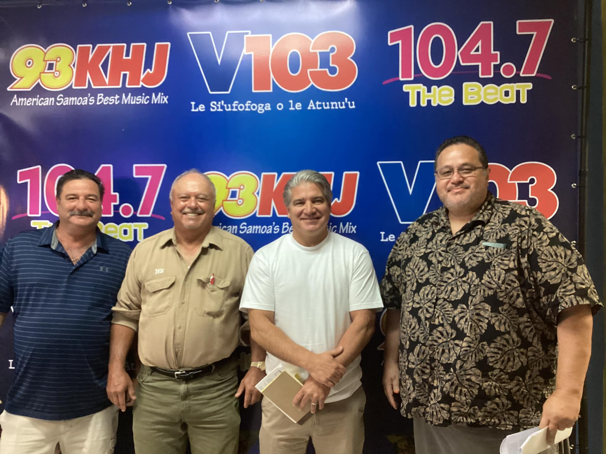
On May 17, 2023, Council member Will Sword, American Samoa Chamber of Commerce Chairman Jason Betham, and Ricardo DeRosa, owner of the Pacific Princes purse seiner, did a radio interview with 93 KHJ ahead of the NOAA’s May 24 public meeting on the sanctuary proposal. They stated the territory’s tuna canning industry will not survive if the new sanctuary goes ahead. This in turn will have ramifications on the American Samoa Government’s revenues, the cost of fuel, food supplies and every aspect of life in the territory.
Below is the complete 13-minute interview:
PRI Sanctuary-Related Documents
- January 19, 2024, Letter to K. Kekuewa, NOAA ONMS providing Council’s justification on fishing regulations recommendations
- December 13, 2023, Letter to J. Armor, NOAA ONMS transmitting Council’s recommendation on fishing regulations for proposed designation of marine sanctuary for the Pacific Remote Islands
- November 6, 2023, Letter to POTUS Biden on Opening PRIA to Fishing
- October 9, 2023, Letter to Secretary of Commerce Raimondo on Circumvention of MSA Process
- July 27, 2023, Letter to POTUS Biden on US Pacific Territories and PRI Sanctuary
- June 2, 2023, Council Letter to N. LeBoeuf, NOAA NOS comments on the Proposed Designation of a National Marine Sanctuary for PRI
- June 1, 2023 – Letter from AS Governor Mauga to DOC Secretary G. Raimondo requesting extension for comment period for Proposed Designation of Marine Sanctuary for the Pacific Remote Islands
- June 1, 2023 – Letter from AS Governor Mauga to K. Kekuewa, NOAA ONMS requesting extension for comment period for Proposed Designation of Marine Sanctuary for the Pacific Remote Islands
- June 1, 2023 – Letter from E. Kingma, HLA to N. LeBoueuf, NOAA NOS comments against the Proposed Designation of Marine Sanctuary for the Pacific Remote Islands
- June 1, 2023 – Letter from W. Gibbons-Fly, ATA to J. Armor, NOAA ONMS comments against the Proposed Designation of Marine Sanctuary for the Pacific Remote Islands
- May 24, 2023 – Letter from CNMI Governor Palacios to J. Armor, NOAA ONMS requesting extension for comment period for Proposed Designation of Marine Sanctuary for the Pacific Remote Islands
- May 3, 2023 – “Amata Welcomes Governors United Stance on Fishing.” Press Release from Congresswoman Aumua Amata Coleman Radewagen.
- April 5, 2023 – Council letter to Richard Spinrad, NOAA on the PRIA national marine sanctuary proposal
- March 30, 2023 – Letter from AS Governor Mauga to POTUS Biden about Proposed Designation of Marine Sanctuary for the Pacific Remote Islands
- March 30, 2023 – Letter from AS Governor Mauga to DOC Secretary G. Raimondo against the Proposed Designation of Marine Sanctuary for the Pacific Remote Islands
- March 27, 2023 – Letter from Territory Governors of American Samoa, CNMI, Guam to POTUS Biden about concerns about the PRIA marine sanctuary proposal
- March 23, 2023 – Letter from Congresswoman Radewagen to DOI Secretary Haaland and DOC Secretary Raimondo about Proposed Designation of Marine Sanctuary for the Pacific Remote Islands
- March 2023 – Proposed National Marine Sanctuary nomination packet
- August 2022 Pacific Islands Fishery News – Pacific Remote Islands Marine National Monument Expansion Proposal
Proposed National Marine Sanctuary in the Northwestern Hawaiian Islands
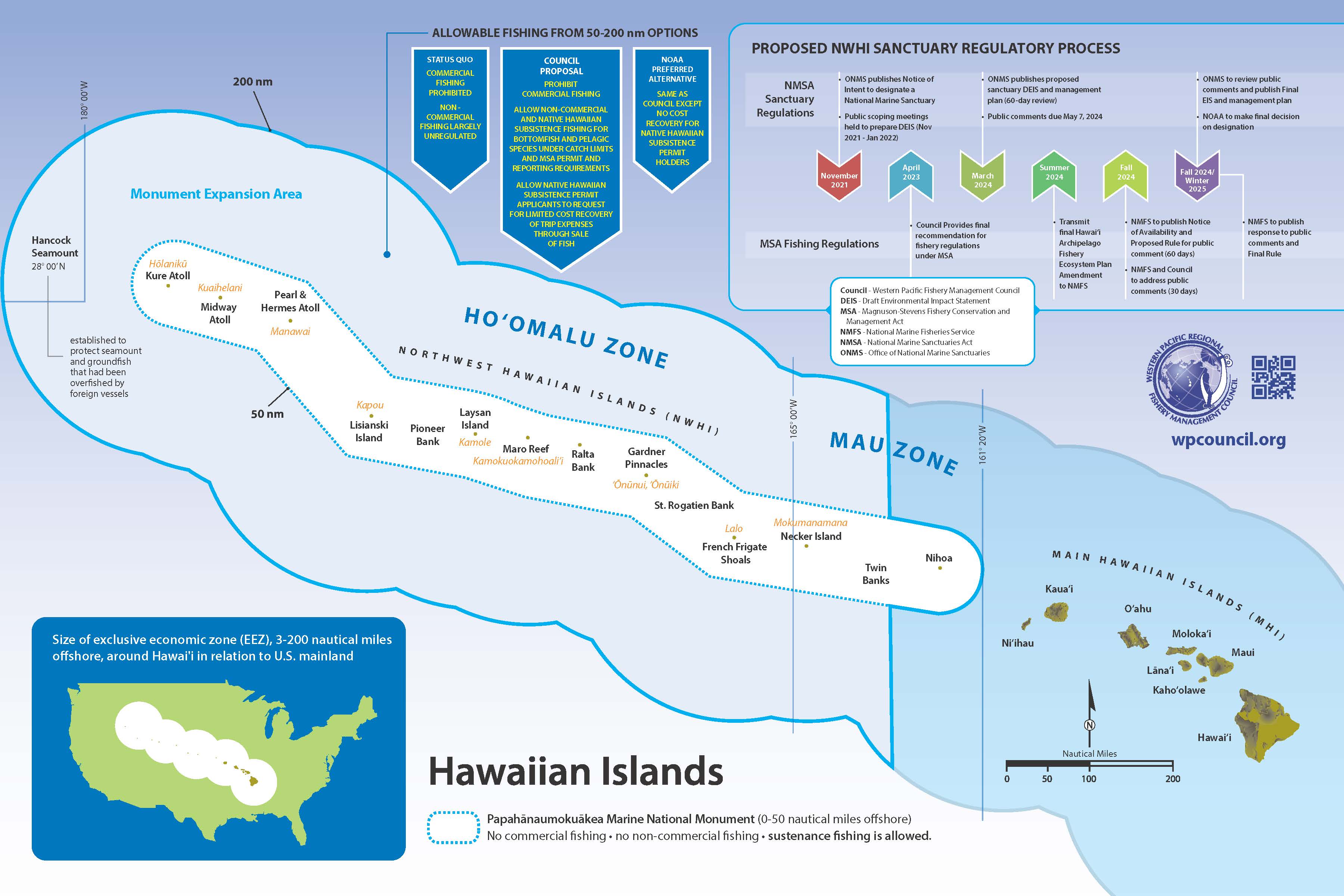
In 2021, NOAA began the public process to designate a National Marine Sanctuary in the NWHI. At its March 2023 meeting, the Council finalized its recommended fishing regulations for the Monument Expansion Area from 50 to 200 miles around the NWHI. The regulations would allow for federal permitting and reporting of non-commercial fishing and Native Hawaiian subsistence fishing practices and prohibit commercial fishing. For more information, see below and visit our NWHI Fisheries page and click on the National Marine Sanctuary Proposal button.
NWHI Sanctuary-Related Documents
- May 7, 2024 – Council comments on Proposed Rule and Draft EIS for the proposed sanctuary designation
- April 14, 2023 – Council response to ONMS to address the request for fishing regulations under NMSA Section 304(a)(5)
- September 27, 2022 – Council letter to John Armor, ONMS about developing fishing regulations for Monument Expansion Area
- June 27, 2022 – Council letter to John Armor, ONMS asking to clarify confusion in the sanctuary designation process
- March 22, 2022 – Council letter to John Armor, ONMS about National Marine Sanctuaries Act, March 22, 2022
- December 2020 – National Marine Sanctuary Designation Proposal for Papahānaumokuākea
Proposed Mariana Trench National Marine Sanctuary
In 2016, the Pew Charitable Trusts and Friends of the Marianas Trench nominated the Mariana Trench as a National Marine Sanctuary. In 2022, the Council provided comments to NOAA on its five-year review of the nomination stating the existing monument management plan should be provided the opportunity to be implemented. NOAA has yet to make a final determination on whether or not the nomination will remain in the inventory for another five-year period. In August 2023, the Friends of the Mariana Trench Marine National Monument withdrew their nomination and requested NOAA remove the proposed sanctuary from the national sanctuary inventory.
Mariana Trench Sanctuary-Related Documents
- September 11, 2023 – NOAA removes Mariana Trench NMS nomination from the Sanctuary Inventory
- August 21, 2023 – Friends of the Mariana Trench Marine National Monument Withdraws Sanctuary Nomination
- February 4, 2023 – Letter from Governor Palacios to John Armor, ONMS about removing the Marine Sanctuary nomination for the Mariana Trench
- March 22, 2022 – Council letter to John Armor, ONMS to remove the proposed Mariana Trench nomination from the National Sanctuary inventory list
- February 22, 2022 – Council Comments on Marianas Sanctuary Listing Review
- February 17, 2022 – Letter from Governor Torres to Kristina Kekuewa requesting a 90 day public comment extension
- July 5, 2017 – Governor Calvo, Guam letter to Secretary Zinke
- December 5, 2016 – Mariana Trench National Marine Sanctuary Proposal
Monuments in the Western Pacific
The Antiquities Act of 1906 obligates federal agencies that manage public lands to preserve for present and future generations the historic, scientific, commemorative, and cultural values of the archaeological and historic sites and structures on these lands. It also authorizes the President to protect landmarks, structures, and objects of historic or scientific interest by designating them as National Monuments.
In 2006, Presidents began using the Antiquities Act to designate Marine National Monuments. Four of the five such monuments are located in the Western Pacific Region, encompass more than half of the U.S. EEZ waters surrounding Hawaii and the U.S. Pacific Territories and remote islands, and prohibit U.S. commercial fishermen from operating in these U.S. waters. President George W. Bush established the Papahānaumokuākea Marine National Monument in June 2006 by Presidential Proclamation 8031; and the Marianas Trench, Pacific Remote Islands, and Rose Atoll Marine National Monuments in January 2009 by Proclamations 8335, 8336, and 8337, respectively.
President Barack Obama expanded the Pacific Remote Islands and Papahānaumokuākea monuments in September 2014 by Proclamation 9173 and August 2016 by Proclamation 9478, respectively. In addition to the United States, in 2014 several other countries around the Pacific established marine protected areas or closed large areas to fishing, including Palau, Kiribati, and the Cook Islands.
The Council has argued that the monument areas are too large and have resulted in negative economic impacts for the U.S. fishing industries and local communities. The areas were already healthy and sustainably managed by the Council prior to the area closures. Management decisions should be based on the best available science and in consultation with local affected communities, not through an arbitrary top-down approach. More research is needed to fully understand the impacts of fishing on each area’s marine resources.
The Council has used time-area closures for many years as a fishery management tool to help increase fish populations and protect vulnerable species. For example, for six months in 1986 the Council implemented a regional closure to bottomfishing for certain deepwater snappers and groupers in areas surrounding Hawaii, American Samoa, Guam and the CNMI. During this time, fishing vessels were prohibited from using bottom tending gear, such as bottom trawls and bottom set gillnets, within the closed areas.
Pacific Remote Islands Marine National Monument
The PRIMNM comprises seven remote islands and atolls in the central Pacific Ocean: Baker Island, Howland Island, Jarvis Island, Johnston Atoll, Kingman Reef, Palmyra Atoll and Wake Island. The monument establishment in 2009 closed all waters to commercial fishing and other extractive activities from 0 nm to 50 nm from each island area. President Obama expanded the monument’s boundaries to 200 nm for Wake, Johnston and Jarvis, but fishing was still allowed from 50 nm to 200 nm from Howland and Baker Islands, and Kingman Reef and Palmyra Atoll. It now covers an area of ~490,000 square miles. PRIMNM is cooperatively managed by the Secretary of Commerce (NOAA) and the Secretary of the Interior (U.S. Fish and Wildlife Service), with the exception of Wake and Johnston Atolls, which are currently managed by the Department of Defense.
In 2022, the Pacific Remote Islands Coalition proposed to President Biden to further expand the Monument to encompass the entire EEZ of the PRIA. The Council published a special issue of its Pacific Islands Fishery News newsletter pointing out impacts and unintended consequences of this proposal, capturing discussions at its June 2022 meeting. The proposal was changed to a sanctuary nomination in 2023.
The Council regulates fishing activities in the PRIMNM through its Pacific Remote Island Areas and Pacific Pelagic Fishery Ecosystem Plans (FEPs). They include marine management zones, protected species provisions, and permit and reporting requirements to foster data collection, monitoring and enforcement.
Federal Fishing Regulations for PRIMNM
Compliance Guide for Fishing in PRIMNM
PRIMNM Correspondence
- October 18, 2022 – Governor Torres, CNMI letter to President Biden supporting AS opposition to the proposed expansion of the PRIMNM
- June 3, 2022 – Council Letter to Assistant Secretary of State Medina providing concerns regarding a possible expansion of PRMNM
- June 16, 2021 – Council Letter to President Biden, POTUS about exploring options to remove commercial fishing prohibitions in the Pacific Remote Islands Marine National Monument
- June 16, 2020 – Starkist Letter to Sec. Pompeo on the PRIMNM
- June 15, 2020 – Council letter to P. Navarro, Director, Office of Trade and Manufacturing Policy on the Impacts of Marine National Monuments and China on US Pacific Tuna Fisheries
- March 10, 2020 – 2020 press release from AS Gov Moliga on reopening marine national monument
- July 11, 2019 – Council comments on fishing prohibition in the Pacific Remote Islands Marine National Monument in response to EO 13792 and 13795
- July 10, 2017 – Review of Certain National Monuments Established Since 1996 and Review of National Marine Sanctuaries and Marine National Monuments Designated or Expanded since April 28, 2007 – Comments from State and Territorial Governments
- July 7, 2017 – Governor Moliga, AS letter to Secretary Zinke
- December 1, 2016 – Letter to POTUS Obama on Rose Atoll, Marianas Trench and Pacific Remote Islands MNM
Papahānaumokuākea Marine National Monument
In December 2000 and January 2001, President Bill Clinton issued Executive Orders EO 13178 and EO 13196 to create the Northwestern Hawaiian Islands (NWHI) Coral Reef Ecosystem Reserve and ensure it had permanent conservation measures. The monument was created in response to a recommendation from the NWHI Coral Reef Ecosystem Reserve Advisory Council, which was established in 2000 to provide guidance on the management of the reserve.
The boundary of the PMNM established in 2006 extended 50 nm around the NWHI. In 2016, President Obama expanded the monument from 50 nm to 200 nm (582,574 square miles). The U.S. Fish and Wildlife Service, NOAA, the State of Hawaii and the Office of Hawaiian Affairs cooperatively manage the PMNM through a Memorandum of Agreement.
The Council regulates fishing activities in the PMNM through its Hawaii Archipelago FEP. Under these regulations, all commercial fishing is prohibited. Noncommercial fishing is allowed only within certain areas and with certain gear restrictions. Non-fishing activities, such as research and Native Hawaiian cultural activities, are allowed within the monument with a permit, but are subject to strict guidelines to minimize any impacts on the area’s natural resources.
Federal Fishing Regulations for PMNM
PMNM Correspondence
- June 15, 2020 – Council letter to P. Navarro, Director, Office of Trade and Manufacturing Policy on the Impacts of Marine National Monuments and China on US Pacific Tuna Fisheries
- May 29, 2020 – CCC Letter to DOC Secretary Ross on EO 13291
- August 28, 2018 – Secretary Ross, DOC response to Marine National Monument removal request
- April 9, 2018 – Council letter to DOC Secretary Ross on Marine National Monuments in the WPR
- July 10, 2017 – Review of Certain National Monuments Established Since 1996 and Review of National Marine Sanctuaries and marine national Monuments Designated or Expanded since April 28, 2007 – Comments from State and Territorial Governments
- July 7, 2017 – Governor Moliga, AS letter to Secretary Zinke about removal of monument designations in the Pacific Ocean
- June 22, 2017 – Governor Ige, HI letter to Secretary Zinke and Secretary Ross
- June 10, 2017 – Review of Certain National Monuments Established Since 1996 – Council Comments
- May 16, 2017 – CCC letter to DOI Secretary Zinke and DOC Secretary Ross about about EO 13792
- May 9, 2017 – Letter to DOC Secretary Ross about the review of Monument designation under the Antiquities Act
- February 23, 2017 – Council Letter to POTUS Trump on the impacts of Marine National Monuments on local fishing industries, seafood consumers and indigenous communities
- December 1, 2016 – 5th Letter to POTUS Obama on Papahanaumokuakea Monument expansion
- August 17-18, 2016 – 4th Letter from WPRFMC to President Obama with monument expansion options
- August 9, 2016 – Council letter to POTUS Obama on PMNM expansion
- August 2, 2016 – Rep. Hanabusa’s letter to POTUS Obama in opposition to PMNM
- August 1-2, 2016 – Sen. Hirono statement about the proposed expansion of PMNM
- July 28, 2016 – Na Koa Ikaika o Ka Lahui Hawai’i letter to POTUS Obama
- July 22, 2016 – Senator Akaka, Governor Ariyoshi and Governor Cayetano’s letter to POTUS Obama opposing PMNM
- July 14, 2016 – Council letter to PORUS Obama in reply to Senator Schatz’s letter for the monument expansion
- July 8, 2016 – Hawaii Seafood Council Letter to POTUS
- June 27, 2016 – Council Coordinating Committee Resolution, Eight Regional Fishery Management Councils and Letter to POTUS
- June 24, 2016 – US Senator Mazie Hirono, Facebook Statement
- June 20, 2016 – Council response letter to Sen. Schatz about his June 16 PMNM proposal to Pres. Obama
- June 16, 2016 – Hawaii Senate President Kouchi sends letter informing Kauai constituents of Schatz’s proposal and the intent of federal officials to hold a meeting on Kauai. The letter was supportive of Schatz’s proposal.
- May 26, 2016 – CCC Resolution on Marine National Monuments
- May 5, 2016 – Mayor of Kauai’s letter to President Obama in opposition
- May 5, 2016 – IHU NUI SPORTFISHING’s letter to President Obama in opposition
- May 3, 2016 – Hawaii House of Representative’s letter to President Obama in opposition
- May 3, 2016 – Governor of CNMI’s letter to President Obama in opposition
- May 2, 2016 – NALO farm’s letter to President Obama in opposition
- April 28, 2016 – Hawaii State Senate’s letter to President Obama in opposition
- April 8, 2016 – Council letter to President Obama in opposition
- April 2, 2016 – Hawaii Longline Association’s letter to President Obama in opposition
- March 25, 2016 – Hawaii Seafood Council’s letter to President Obama in opposition
- March 23, 2016 – Senator Schatz’s letter to President Obama in favor of PMNM expansion
- March 22, 2016 – Maui Co-Op fishing association’s letter to President Obama in opposition
- March 15, 2016 – HFACT’s letter to President Obama in opposition
- March 11, 2016 – HCR131 – Urging the President of the United States to deny any request to expand the PMNM and oppose any action to the expand the monument
- March 7, 2016 – PIFG’s letter to President Obama in opposition
- January 29, 2016 – 7 Hawaiian’s letter to President Obama in favor of PMNM expansion
Marianas Trench Marine National Monument
Encompassing the deepest oceanic trench on Earth, the MTMNM covers 95,389 square miles and has three units: the Mariana Trench Unit, the Volcanic Unit, and the Islands Unit. The purpose of this designation was to preserve a diverse range of geological, biological, and cultural resources, including seamounts, underwater volcanoes, and submerged cultural sites. The monument also recognized the cultural and historical significance of the CNMI and the importance to the indigenous Chamorro and Carolinian peoples. The MTMNM is cooperatively managed by NOAA, the U.S. Fish and Wildlife Service and the CNMI government, in cooperation with the Department of Defense and the Department of State.
The Council regulates fishing activities in the MTMNM through its Mariana Archipelago FEP. All commercial fishing is prohibited and noncommercial fishing is allowed within certain areas and with certain gear restrictions. Mining, drilling and other extractive activities are prohibited. Non-fishing activities, such as research and cultural activities, are allowed within the monument with a permit, but are subject to strict guidelines to minimize any impacts on the deep-sea ecosystems.
Regulations provide for customary exchange, which permits fishermen and the community to exchange fish and other marine resources for goods and/or services for cultural, social, or religious reasons. Customary exchange may include cost recovery through monetary reimbursements for actual trip expenses. On June 6, 2024, NOAA and US Fish and Wildlife Service, in cooperation with the CNMI, finalized the final management plan and Environmental Assessment for the Marina Trench Marine National Monument.
Federal Fishing Regulations for MTMNM
Compliance Guide for Fishing in MTMNM
NOAA’s FINAL Marianas Trench Monument Management Plan and Environmental Assessment
MTMNM Correspondence
- February 4, 2023 – Letter from Governor Palacios to J. Armor, NOAA ONMS about removing the Marine Sanctuary nomination for the Mariana Trench
- June 15, 2020 – Council letter to P. Navarro, Director, Office of Trade and Manufacturing Policy on the Impacts of Marine National Monuments and China on US Pacific Tuna Fisheries
- October 2, 2017 – Governor Torres and Governor Calvo to POTUS Trump about Marianas Trench Marine National Monument
- July 11, 2017 – Governor Torres to DOI Secretary Ryan Zinke about the Marianas Trench Maine National Monument Review
- July 11, 2017 – CNMI Senate Resolution 20-05 to restore fishing and mineral resource extraction rights to CNMI
- December 1, 2016 – Letter to POTUS Obama on Rose Atoll, Marianas Trench and Pacific Remote Islands MNM
Rose Atoll Marine National Monument
The Rose Atoll MNM was established in 2009. It covers 8,625 square miles and includes the waters and submerged lands. Rose Atoll is named for the pink color of the fringing reef. This monument is cooperatively managed by NOAA and the U.S. Fish and Wildlife Service, in cooperation with the Department of State, the Department of Defense and the American Samoa Government.
The monument prohibits all commercial fishing and other extractive activities within its boundaries. However, subsistence fishing by local communities and recreational fishing are allowed in the monument and subject to certain restrictions and regulations. For example, recreational fishing is allowed for pelagic species such as tuna and billfish, but is prohibited for bottomfish and other reef-associated species.
Council regulations require that all vessels entering the monument must have a valid permit and follow certain protocols aimed at minimizing their impact on the marine environment. These protocols include requirements for proper handling and release of nontarget species, restrictions on the use of certain fishing gear and limitations on the amount of fishing gear that can be used.
Federal Fishing Regulations for Rose Atoll MNM
Compliance Guide for Fishing in Rose Atoll MNM
Rose Atoll MNM Correspondence
Removing Fishing Prohibitions in Marine National Monuments
Correspondence
- May 29, 2020 – Council Coordination Committee letter to DOC Secretary Ross about Executive Order 13921 and Marine National Monuments
- August 15, 2019 – Hawaii Longline Association letter to POTUS Trump to remove the Marine National Monument fishing prohibitions
- August 11, 2019 – South Pacific Tuna Corporation letter to POTUS Trump to remove the Marine National Monument fishing prohibitions
- July 11, 2019 – Council Letter to POTUS Trump to remove the Marine National Monument fishing prohibitions
- July 2019 – Maui Coop Letter to POTUS Trump to remove the Marine National Monument fishing prohibitions
- July 1, 2019 – Pacific Islands Fisheries Group Letter to POTUS Trump to remove the Marine National Monument fishing prohibitions
- March 14, 2019 – “Amata Urges Congress to Reform Marine Monuments.” Press Release from U.S. Congresswoman Aumua Amata Coleman Radewagen.
- September 20, 2018 – Council Letter to POTUS Trump regarding removal of the monument fishing prohibition
- September 17, 2018 – Hawaii Longline Association letter to POTUS Trump to remove the commercial fishing prohibitions in the Marine Monuments
- April 9, 2018 – PRFMC letter to DOC Secretary Ross on the removal of the Marine National Monuments in the WPR
- April 14, 2017 – Council Letter to POTUS Trump concerning the monument fishing prohibitions
- March 3, 2017 – Pacific Island Governor’s Letter to POTUS Trump to remove fishing provisions applicable to the Marine National Monuments
Area-Based Management
High Seas
Areas beyond national jurisdiction – the high seas – are those marine areas outside of the 200 nm EEZ of each coastal nation. These waters cover about half of Earth’s surface and make up about two-thirds of the world’s ocean. There are several treaties and varying efforts to manage and protect some important high seas areas.
The United Nations hosted its first Intergovernmental Conference on Marine Biodiversity of Areas Beyond National Jurisdiction (BBNJ) in 2018. The reason for convening the conference was the growing recognition that the high seas are facing significant threats from human activities such as overfishing, pollution, and climate change, which are affecting the health and functioning of marine ecosystems. At the time, there was no comprehensive legal framework governing the conservation and sustainable use of these areas, and there was a need for international cooperation to address these issues.
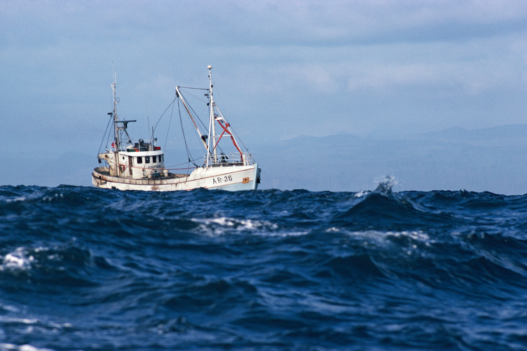
BBNJ negotiations have finalize and will be ratified by the end of 2023, which includes a legal framework for the use of area-based management tools on the high seas. The Council is concerned about this since pelagic tuna fisheries rely on high seas fishing access to fulfill fleet demands given closures of U.S. waters around Hawaii and the PRIA.
A summary of the fifth session held in March 2023 is available here.
Southern Exclusion Zone
The Southern Exclusion Zone is a management area created by the False Killer Whale Take Reduction Plan, which is implemented under the Marine Mammal Protection Act. The area closes to deep-set longline fishing if the fishery reaches a certain level of observed false killer whale bycatch in a given year. It is located in the U.S. EEZ around Hawai’i bounded by 165° 00′ W longitude on the west, 154° 30′ W longitude on the east, the PMNM and the Main Hawaiian Islands (MHI) Longline Fishing Prohibited Area on the north, and the EEZ boundary on the south.
Main Hawaiian Islands Longline Fishing Prohibited Area
This longline exclusion zone prohibits longline fishing around the MHI (50 CFR 665.806(a)(2)). The exclusion zone was created in 1992 to prevent gear conflicts between longline fisheries and pelagic troll and handline fisheries (57 FR 7661, March 2, 1992).
Current National Marine Sanctuaries in the Western Pacific
- National Marine Sanctuary of American Samoa – Fishing for pelagic species is allowed around Aunu’u Island, but bottomfishing is prohibited.
- Hawaiian Islands Humpback Whale National Marine Sanctuary
American Samoa Large Vessel Prohibited Area
In 2002, the Council established the Large Vessel Prohibited Area (LVPA) to minimize competition between the large-vessel fishing fleet and smaller traditional double-hulled catamaran boats called alias. In 2015, the Council recommended an exemption to the LVPA for U.S.-permitted longline vessels of 50 feet in length or greater, based in American Samoa, allowing the fleet to fish within about 12-17 nm from shore around Tutuila, Swains and Manua Islands. The American Samoa Government filed a lawsuit in 2016 against the federal government, arguing that the amendment to the LVPA for longline vessels violated the territory’s Deeds of Cession, which was initially ruled in their favor. In 2020, this decision was reversed by a three-judge panel and subsequently denied by the Supreme Court.
The final decision effective July 6, 2021, reinstated the LVPA exemptions established in the 2016 final rule (86 FR 36239). In the last six months of 2021, trolling catch rates for skipjack tuna nearly doubled while effort from the American Samoa longline fishery within the U.S. EEZ around American Samoa increased by 25% from 2020. Only a single alia vessel has been operational and landings cannot be reported due to data confidentiality rules.
Council-Related Efforts on Area-Based Management
Area-based management is one of many tools used by the regional fishery management councils to conserve and sustainably manage fisheries and limit potential adverse effects of fisheries to marine ecosystems. Discrete geographic areas with specific regulatory restrictions have been established to meet various conservation objectives including conserving ecosystems and associated biodiversity, minimizing impacts to sensitive or important habitat types, and conserving vulnerable keystone species. Management areas have also been established to address numerous other spatially driven management challenges, such as issues related to fishery allocations, fishery catch limits, protecting spawning fish from disturbance, or addressing bycatch concerns.
The Council Coordination Committee (CCC) formed a subcommittee on area-based management in May 2021 to assist the councils in coordinating with NOAA to achieve the goals in the Executive Order 14008. President Biden’s goal is to conserve at least 30% of lands and waters by 2030. The CCC subcommittee is analyzing existing managed areas with respect to how they achieve the principles listed in the Conserving and Restoring America the Beautiful report. The Biden Administration released a one-year report in December 2021.
The CCC reviewed the final report at its May 2023 meeting. Federal agencies are creating an American Conservation and Stewardship Atlas, which will define areas fully or partially meeting criteria under the America the Beautiful Initiative.
Scientific and Statistical Committee Working Group
The Council’s Scientific and Statistical Committee developed a paper to inform managers and stakeholders on the utility of area-based management tools to address domestic priorities as well as international negotiations.
The CCC and the Council have provided the following correspondence regarding the America the Beautiful 30×30 Initiative and the Atlas.
- March 7, 2022 – Council letter to Richard Spinrad, NOAA administrator commenting on EO 14008
- February 25, 2022 – CCC Letter to DOI Secretary Debra Haaland regarding the RFI on the American Conservation and Stewardship Atlas
International Workshop on Area-Based Management of Blue Water Fisheries
The Council hosted the International Workshop on Area-Based Management of Blue Water Fisheries from June 15 to 17, 2020. The workshop included 34 participants from across the globe. The panelists and participants included top area-based fishery management experts from intergovernmental agencies, nongovernmental organizations, regional fisheries management organizations, and academia, many of whom bridge the gap between science and policy. The workshop was co-chaired by world-renowned scientists Dr. Ray Hilborn (University of Washington) and Dr. Vera Agostini (United Nations Food and Agriculture Organization).
Workshop Report and Related Publications
Emerging from the Workshop were two noteworthy publications. Workshop participants were invited to serve as co-authors on a 2021 Publication in Fish and Fisheries: “Area-based management of blue water fisheries: Current knowledge and research needs.” This paper was lead by a Council SSC member as first author and Council staff as senior author. This paper was shared with United Nations Committee of Fisheries at its 2022 meeting
In 2022, SSC member Ray Hilborn and Council staff Mark Fitchett co-authored a paper with others called “Trade-offs between bycatch and target catches in static versus dynamic fishery closures” addressing issues noted in the 2020 workshop and their 2021 paper. This paper focused on dynamic vs static protected areas to reduce bycatch or incidental catch of threatened species in fisheries.
The incidental catch of threatened species is still one of the main barriers to fisheries sustainability. What would happen if we closed 30% of the ocean to fishing with the goal of reducing bycatch? Analyzing 15 different fisheries around the globe, we found that under static area management, such as classic no-take marine area closures, observed bycatch could be reduced by 16%. However, under dynamic ocean management based on observed bycatch and closing the same total area but fragmented in smaller areas that can move year to year, that reduction can increase up to 57% at minimal or no loss of target catch.
Executive Orders
EO 14008, January 20, 2021: Tackling the Climate Crisis at Home and Abroad, aka “America the Beautiful” – This action by President Biden seeks to cement the climate crisis at the center of U.S. foreign policy and national security and commits to the goal of conserving at least 30% of the nation’s lands and oceans by 2030.
EO 14008 Correspondence
- March 7, 2022 – Council letter to Richard Spinrad, NOAA commenting on EO 14008
- February 25, 2022 – CCC Letter to DOI Secretary Debra Haaland regarding the RFI on the American Conservation and Stewardship Atlas
- March 31, 2021 – Council Letter to Secretary Gina M. Raimondo, DOC to provide recommendations on Executive Order 14008
- March 29, 2021 – Council Letter to Secretary Debra A. Haaland, DOI to provide comments on the implementation of Executive Order 14008
EO 13921, May 7, 2020: Promoting American Seafood Competitiveness and Economic Growth – An initiative by President Trump aimed at boosting the seafood industry in the United States through various strategies and policies.
EO 13792, April 26, 2017: Review of Designations Under the Antiquities Act – Action by President Trump that directed the Secretary of the Interior to review and potentially modify or rescind national monument designations made under the Antiquities Act by previous administrations.
EO 13792 Correspondence
- November 9, 2017 – 24 members of Congress send letter to POTUS Trump about EO 13792
- July 25, 2017 – House Democrats Letter to DOC Secretary Ross about National Marine Sanctuaries and Monuments
- July 10, 2017 – Review of Certain National Monuments Established Since 1996 and Review of National Marine Sanctuaries and marine national Monuments Designated or Expanded since April 28, 2007 – Comments from State and Territorial Governments
- July 11, 2017 – Governor Torres, CNMI letter to DOI Secretary Zinke
- June 9, 2017 – Congressman Kilili to DOI Secretary Zinke – Monuments comments
- June 7, 2017 – Governor Moliga, AS letter to DOI Secretary Zinke
- July 5, 2017 – Governor Calvo, Guam letter to DOI Secretary Zinke
- June 22, 2017 – Governor Ige, HI letter to DOI Secretary Zinke and DOC Secretary Ross
- June 5, 2017 – Gov. Lolo’s Letter to DOS Secretary Tillerson concerning AS fisheries and monuments
- May 16, 2017 – CCC’s letter to Secretaries of DOI and DOC concerning EO 13792
- May 9, 2017 – Council Letter to DOC Secretary Ross about the Monument review with attachments
- April 26, 2017 – Council letter to DOI Secretary Zinke concerning EO on monuments
- April 26, 2017 – Council letter to DOC Secretary Ross on sanctuary overlay

